The Future of Educational Robotics

Discover how these new technologies work together to expand the possibilities of competitive robotics.


VEX GPS Sensor

Install the Game Positioning System (GPS) on your robot
Apply the VEX Field Code to the field interior
Track X, Y Position and Heading on the field

 

Overview
Commercial Global Positioning System (GPS) uses satellite signals and satellite locations to triangulate a position, but not heading. The newly designed VEX GPS uses a patent-pending VEX Field Code to triangulate both position and heading.
 
How the VEX GPS Sensor works
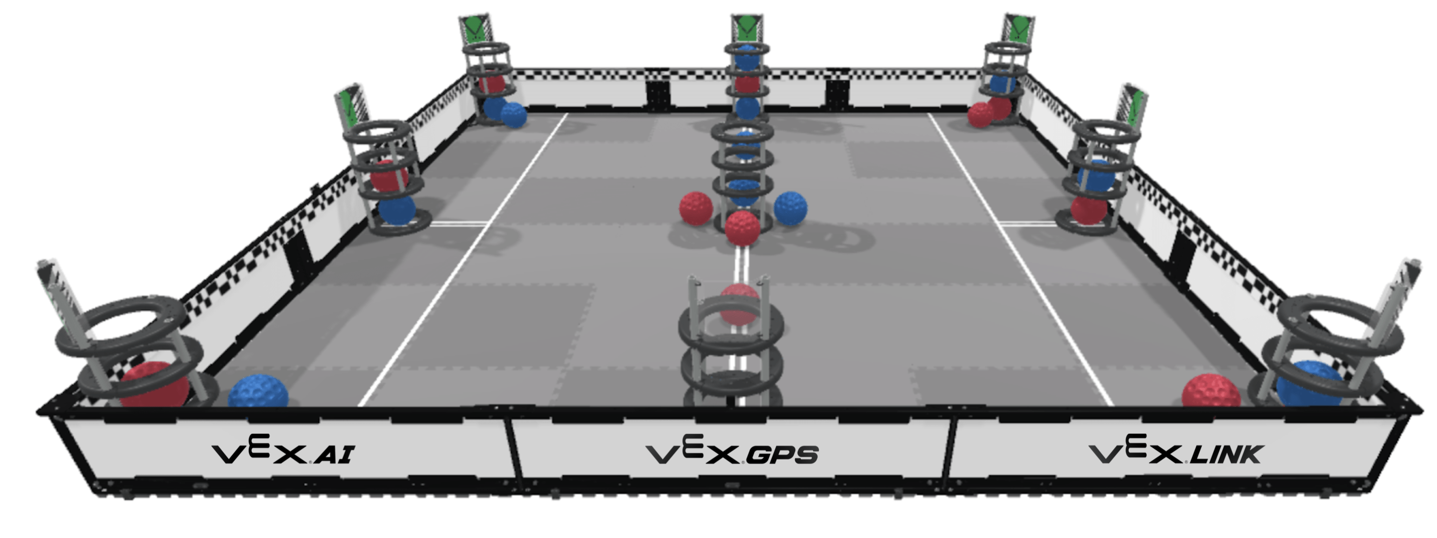
The Field Code is mounted around the inside perimeter of the VEX field. That checkerboard pattern in the Field Code is used to identify the location for each individual block in that pattern. Like satellites, this creates hundreds of known locations. To sense the Field Code, the VEX GPS sensor, a black and white camera, is mounted on the rear of the robot and facing rearwards. The camera only needs to see about 17” of the code strip to triangulate a position and direction. VEX GPS is an absolute position system, so it does not drift nor does it require calibration on a per-field basis.
 
How it applies
Knowing your Robot’s location is critical to path planning algorithms to allow autonomous movement from point to point.

VEX AI Vision System

Explore Artificial Intelligence
Detect hundreds of objects simultaneously
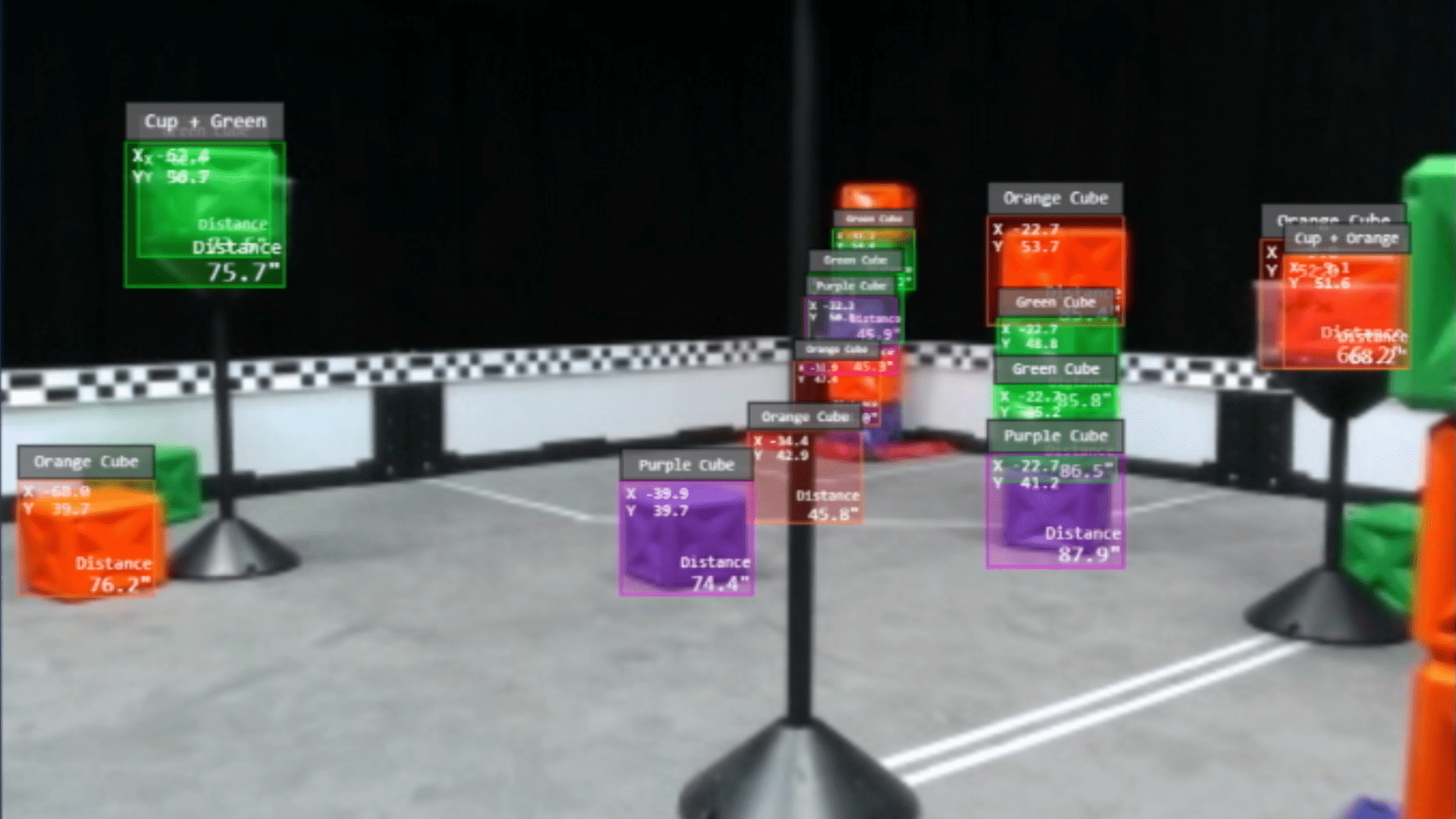
Determine object type, location, and distance
Experience a LIVE view of augmented reality


Overview
The most common use of Artificial Intelligence is object recognition.  Humans take object recognition for granted, but robots need some help.  The main reason that most robot competitions use human drivers is the robot’s lack of knowledge of its surroundings.  VEX AI uses software and neural networks that can detect the game pieces, goals, and objects that VEX robots want to interact with.
 
How the VEX AI Vision System works
Many object classification systems are designed to determine the one subject of the image with some certainty, such as a cat with 96% certainty.  The VEX AI system is designed to identify hundreds of instances of various objects within an image and locate their screen coordinate.  In addition the VEX AI system measures distance to each object using stereo vision. That information is combined, along with the position information from the VEX GPS to locate each object in 3D space.
 
How it applies
Writing code to sort through the data and make informed and strategic decisions is a key part of Computer Science and competitive autonomous robotics. 

VEX LINK Communications

Activate VEX LINK Communications
Communicate from Robot-to-Robot
Send messages and data between bots
Coordinate robot actions
 
Overview
The ability of robots to communicate together is critical to autonomous robot operations. Coordinated efforts between robots require knowledge of each other's location, allowing tasks to be divided between robots. Changes in strategy need to be communicated as well.
 
How the VEX LINK Communication System works
The VEX LINK communication system uses a second VEX V5 VEXnet radio connected to each V5 Robot Brain to establish a robot-to-robot link. Alphanumeric strings can be sent between robots using a “message_link” protocol, similar to text messaging. Large blocks of data can also be sent using a “serial_link” protocol, similar to USB data.
 
How it applies
VEX LINK is critical to allowing the robot to share the results of their AI object detection and GPS locations.  VEX LINK is critical to allowing the robot to share the results of their AI object detection and GPS locations. This enables both robots to work with each other's information, essentially giving them two points of view.

Sensor Fusion Map

Locate robots, objects, and goal on the map

Share information from robot to robot

Watch it all in real time via WiFi


Overview
Sensor fusion involves collecting data from multiple sources and combining it in a way to get a better picture of the surroundings. 


How the Sensor Fusion Map works

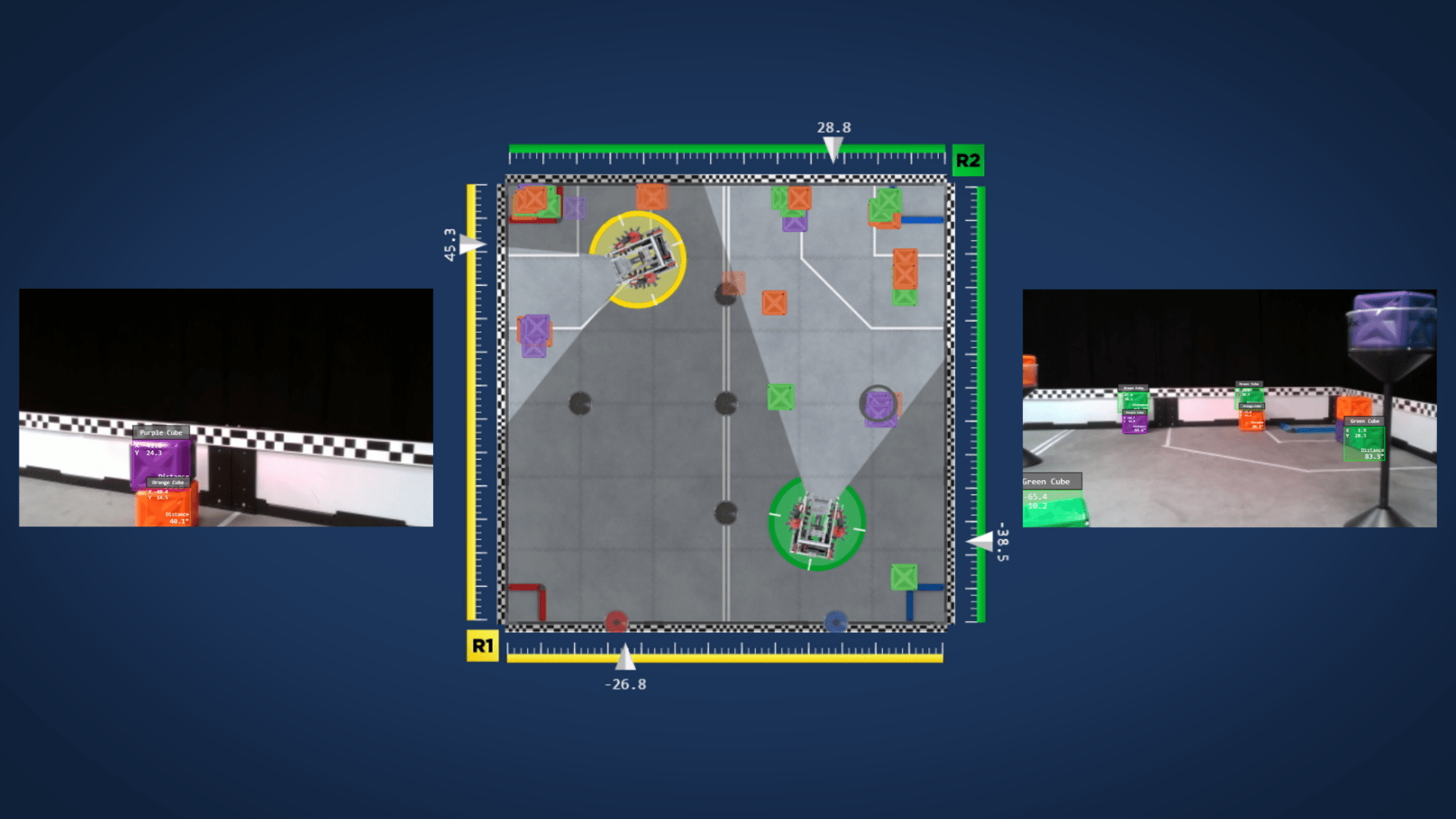
Sensor fusion is used to make a map of the field and the objects on that field. This combines the location of the robot and the relative position of the objects it sees, allowing each object to be accurately located on the field. Objects outside the robot's field of view are stored and time stamped because as time goes by, there is a chance that that specific object is no longer where it was last seen.

How it applies
The knowledge provided by Sensor Fusion is the critical first step to determining and executing autonomous robot operations. This wide array of information is also critical to coders who are trying to expand robot capabilities. All of this data is sent via WiFi to your device’s browser so you can watch it all remotely. The WiFI data can include an AI video feed with information overlays, the Sensor Fusion map, and any other information available to the V5 Brain.


VEX AI Competition

Presented by the REC Foundation
Overview
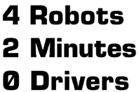
VEX AI, VEX GPS, and VEX LINK, and the resulting Sensor Fusion create an opportunity for students to take their autonomous robots a level up! The VEX AI Competition pushes the boundaries of robotics competitions. The game is separate from the VRC and VEX U competitions.
 
Here's how it works
Each team brings two robots that they design and build to work as a team. Teams can 3D print and machine parts. Teams can use custom electronics, and there are no motor quantity limits. This game will be open to High School students and College students alike. Game registration will include the hardware needed for that year’s competition to run VEX AI, VEX GPS, VEX LINK, and Sensor Fusion Map.

More information to follow!
  • Apr 27, 2020
  • Comments: 0
Comments: 0

No comments

Leave a Reply

Your email address cannot be published. Required fields are marked*